![](/images/other/stat-length.png)
La Garde-Freinet - Roches blanches
Sugg
Utilisateur
![Longueur](/images/other/stat-length.png)
![Altitude max](https://static1.geolcdn.com/siteimages/upload/files/1508320355ic_sort_altitude_max_24dp.png)
![Dénivelé positif](https://static1.geolcdn.com/siteimages/upload/files/1508320355ic_sort_den_pos_24dp.png)
![Km-Effort](/images/other/stat-length.png)
![Altitude min](https://static1.geolcdn.com/siteimages/upload/files/1508320355ic_sort_altitude_min_24dp.png)
![Dénivelé négatif](https://static1.geolcdn.com/siteimages/upload/files/1508320355ic_sort_den_neg_24dp.png)
![Boucle](https://static1.geolcdn.com/siteimages/upload/files/16400158638029165_repeat_loop_refresh_sync_direction_icon.png)
![Marche](https://static1.geolcdn.com/sitytour/trail-icons/101.png)
5h31
Difficulté : Moyen
![Scannez ce code QR pour ouvrir la randonnée dans l'application SityTrail](https://capi.geolives.com/qq0zvz2zws4bq2lad0pu/sitytour/trails/306697/qr.png?size=200)
Application GPS de randonnée GRATUITE
À propos
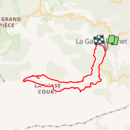
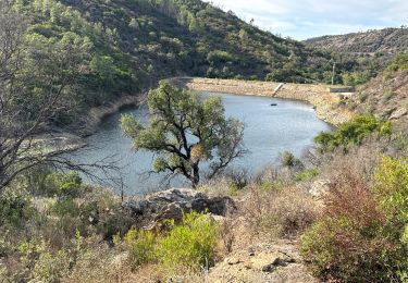
Randonnée Marche de 17,2 km à découvrir à Provence-Alpes-Côte d'Azur, Var, La Garde-Freinet. Cette randonnée est proposée par Sugg.
Description
Bonjour,
Rando Daniel du 28-05-14 avec Restons en forme Draguignan,Parking à la sortie du village.
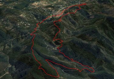
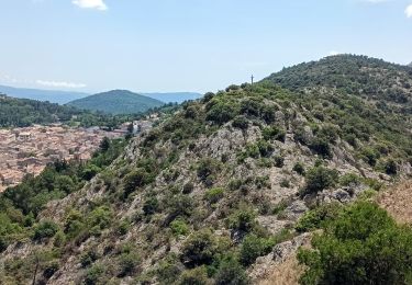
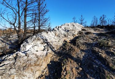
Objectif : les roches blanches, la Croix des Maures et Fort Freinet malheureusement inaccessible car en travaux.
Beau parcours avec des passage assez délicat.
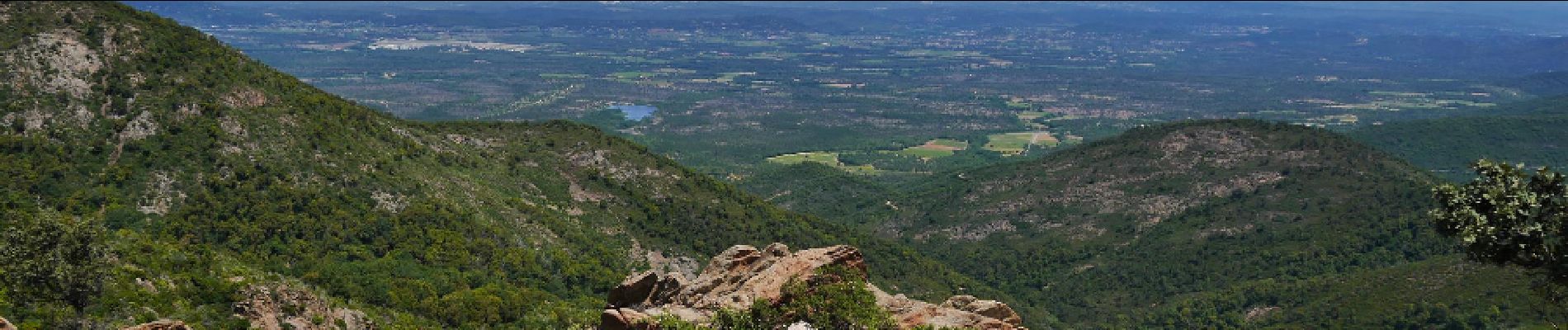
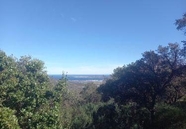
Des points de vue remarquables.
Beau temps, un peu de Venturi dans les cols.
Localisation
Commentaires
Randonnées à proximité
![Randonnée Marche La Garde-Freinet - Serre Long - Ruisseau des neuf Riaux - Moulin de Blanche - Barrage - Rucher de Blay - Fort Freinet - Croix des Maures - Photo](https://media.geolcdn.com/t/375/260/ce777452-e991-4230-8a3a-fe54e13fa23c.jpg&format=jpg&maxdim=2)
![Marche Marche](https://static1.geolcdn.com/sitytour/trail-icons/101.png)
Marche
![](/images/other/stat-length.png)
![](https://static1.geolcdn.com/siteimages/upload/files/16400158638029165_repeat_loop_refresh_sync_direction_icon.png)
![Randonnée Marche Le Cannet-des-Maures - lac des escarcets - Photo](https://media.geolcdn.com/t/375/260/ext.jpg?maxdim=2&url=https%3A%2F%2Fstatic1.geolcdn.com%2Fsiteimages%2Fupload%2Ffiles%2F1553511878bg_sport_marche.png)
![Marche Marche](https://static1.geolcdn.com/sitytour/trail-icons/101.png)
Marche
![](/images/other/stat-length.png)
![](https://static1.geolcdn.com/siteimages/upload/files/16400158638029165_repeat_loop_refresh_sync_direction_icon.png)
![Randonnée sport La Garde-Freinet - 2024-10-30_07h08m24_Les roches blanches la croix des maures - Photo](https://media.geolcdn.com/t/375/260/ext.jpg?maxdim=2&url=https%3A%2F%2Fsecurestorage.geolives.com%2Fsitytour%2Ftrail-bg%2Fdefault.jpg)
sport
![](/images/other/stat-length.png)
![](https://static1.geolcdn.com/siteimages/upload/files/16400158638029165_repeat_loop_refresh_sync_direction_icon.png)
![Randonnée Marche La Garde-Freinet - La Mourre, La Garde-Freinet-22-05-24 - Photo](https://media.geolcdn.com/t/375/260/d83ec998-34f1-4f9a-9ad9-3f2fca5f6ed5.jpg&format=jpg&maxdim=2)
![Marche Marche](https://static1.geolcdn.com/sitytour/trail-icons/101.png)
Marche
![](/images/other/stat-length.png)
![](https://static1.geolcdn.com/siteimages/upload/files/16400158638029165_repeat_loop_refresh_sync_direction_icon.png)
![Randonnée Marche La Garde-Freinet - Garde freinet rev - Photo](https://media.geolcdn.com/t/375/260/7c0f54ba-5dae-4e90-b68b-91a753a14687.jpg&format=jpg&maxdim=2)
![Marche Marche](https://static1.geolcdn.com/sitytour/trail-icons/101.png)
Marche
![](/images/other/stat-length.png)
![](https://static1.geolcdn.com/siteimages/upload/files/16400158638029165_repeat_loop_refresh_sync_direction_icon.png)
![Randonnée A pied La Garde-Freinet - Fort Freinet-la Garde-Freinet-02-06-23 - Photo](https://media.geolcdn.com/t/375/260/a55d6a88-f340-481f-bdaf-db37fcbe61e6.jpg&format=jpg&maxdim=2)
![A pied A pied](https://static1.geolcdn.com/sitytour/trail-icons/100.png)
A pied
![](/images/other/stat-length.png)
![](https://static1.geolcdn.com/siteimages/upload/files/16400158638029165_repeat_loop_refresh_sync_direction_icon.png)
![Randonnée Marche Grimaud - Grimaud - le pont des fées - Mont Roux 11.3.23 - Photo](https://media.geolcdn.com/t/375/260/b931d4cf-3c48-45c3-9286-94f622997895.jpg&format=jpg&maxdim=2)
![Marche Marche](https://static1.geolcdn.com/sitytour/trail-icons/101.png)
Marche
![](/images/other/stat-length.png)
![](https://static1.geolcdn.com/siteimages/upload/files/16400158638029165_repeat_loop_refresh_sync_direction_icon.png)
![Randonnée Marche La Garde-Freinet - les roches blanches - La Garde Freinet - Photo](https://media.geolcdn.com/t/375/260/f87c2506-3a8b-4a88-ba3e-49e9b5d399bc.jpg&format=jpg&maxdim=2)
![Marche Marche](https://static1.geolcdn.com/sitytour/trail-icons/101.png)
Marche
![](/images/other/stat-length.png)
![](https://static1.geolcdn.com/siteimages/upload/files/16400158638029165_repeat_loop_refresh_sync_direction_icon.png)
![Randonnée Marche La Garde-Freinet - la Garde Freinet-Les Roches Blanches - Photo](https://media.geolcdn.com/t/375/260/ext.jpg?maxdim=2&url=https%3A%2F%2Fstatic1.geolcdn.com%2Fsiteimages%2Fupload%2Ffiles%2F1553511878bg_sport_marche.png)
![Marche Marche](https://static1.geolcdn.com/sitytour/trail-icons/101.png)
Marche
![](/images/other/stat-length.png)
![](https://static1.geolcdn.com/siteimages/upload/files/16400158638029165_repeat_loop_refresh_sync_direction_icon.png)